• Donate
  • Contact
  • Facebook
  • Instagram
  • YouTube
menu
  • Visit A Preserve
  • Who We Are
    • Our Mission
    • Board & Staff
    • Collaboration
    • Financials
    • Library
  • Get Involved
    • Trail Steward
    • Salmon Docent
    • Stewardship Work Parties
    • K-12 Outdoor Programs
  • Ways To Give
    • Cash
    • Stocks, Donor Advised Funds, IRAs
    • Bequests, Estate Plans & Wills
    • Gifts of Land
    • Other Ways to Give
    • Become a Business Partner
  • Conserved Lands
    • Conservation Map
    • Conserving Key Habitats
    • Conservation Areas
      • Budd & Henderson Inlets
        • Bayfield Resource Co. Forest Conservation Easement
        • Bayfield Resource Co. Gull Harbor Conservation Easement
        • Brown Preserve
        • Cushman Conservation Easement
        • Hale Preserve
        • Harmony Farm Preserve
        • Howe Conservation Easement
        • Lonseth Preserve
        • Scheidt-Mayer Conservation Easement
        • Stephens Preserve
        • Woodland Creek
      • Black River / Chehalis Watershed
        • Aldridge Conservation Easement
        • Baretich Conservation Easement
        • Bergquist Conservation Easement
        • Black River Conservation Easement and Preserve
        • Darlin Creek Preserve
        • Davis Conservation Easement
        • Decker Creek Wetland Complex
        • DeFelice Preserve
        • Edwards Conservation Easement
        • Gordon Farm Conservation Easement
        • Heertje Conservation Easement
        • Holm-Rader Farm Conservation Easement
        • Leitner Prairie Conservation Easements
        • Tilley Wetlands Preserve
        • West Rocky Prairie
      • Cowlitz Watershed
        • Cowlitz River Preserve
      • Deschutes Watershed
        • Anderson Preserve
        • Bentley Conservation Easement
        • Bush Prairie Farm Conservation Easement
        • Parsons Family Farm Conservation Easement
        • Shermer-Deschutes Preserve
        • Springer Lake Preserve
        • Spurgeon Valley Preserve
        • Stewart Conservation Easement
        • Stewart-Deschutes Preserve
        • Yale Preserve
      • Green Cove Creek Wetlands
        • Harper Conservation Easement
        • Kaiser Preserve
        • LOTT Alliance Conservation Easement
        • Ekar-Overhulse Preserve
        • Paul-Leigh Conservation Easement
        • SPSCC Foundation Property
        • YWCA
      • Hood Canal
        • Brothers Beach Conservation Easement
      • Oakland Bay & Goldsborough Creek Watershed
        • Bayshore Preserve
        • Granquist Preserve
        • Hilburn Preserve
        • North Fork Goldsborough Creek Preserve
        • Oakland Bay Historical Park Conservation Easement
        • Olli Conservation Easement
        • Pannell Preserve
        • Rose Preserve
        • North Fork Goldsborough Creek Preserve – Rose Addition
        • Sunset Bluffs
        • Twin Rivers Ranch Preserve
      • Steamboat Conservation Partnership Region
        • Adams Cove Preserve
        • Appleby Conservation Easement
        • Davidson-Bergman Conservation Easement
        • Lower Eld Preserve
        • McIntyre Conservation Easement
        • McLane Point Preserve/Conservation Easement
        • Randall Preserve / Allison Springs
        • Schmidt Conservation Easements
        • Triple Creek Farm Conservation Easement
        • Willits Conservation Easement
        • Willits Tree Farm Conservation Easement
        • Wynne Tree Farm Conservation Easements
    • Inspiring Kids Preserve
    • Conserve Your Land
    • Managing Our Preserves
  • News
  • Events
  • Donate
  • Contact
  • Visit A Preserve
  • Who We Are
    • Our Mission
    • Board & Staff
    • Collaboration
    • Financials
    • Library
  • Get Involved
    • Trail Steward
    • Salmon Docent
    • Stewardship Work Parties
    • K-12 Outdoor Programs
  • Ways To Give
    • Cash
    • Stocks, Donor Advised Funds, IRAs
    • Bequests, Estate Plans & Wills
    • Gifts of Land
    • Other Ways to Give
    • Become a Business Partner
  • Conserved Lands
    • Conservation Map
    • Conserving Key Habitats
    • Conservation Areas
      • Budd & Henderson Inlets
        • Bayfield Resource Co. Forest Conservation Easement
        • Bayfield Resource Co. Gull Harbor Conservation Easement
        • Brown Preserve
        • Cushman Conservation Easement
        • Hale Preserve
        • Harmony Farm Preserve
        • Howe Conservation Easement
        • Lonseth Preserve
        • Scheidt-Mayer Conservation Easement
        • Stephens Preserve
        • Woodland Creek
      • Black River / Chehalis Watershed
        • Aldridge Conservation Easement
        • Baretich Conservation Easement
        • Bergquist Conservation Easement
        • Black River Conservation Easement and Preserve
        • Darlin Creek Preserve
        • Davis Conservation Easement
        • Decker Creek Wetland Complex
        • DeFelice Preserve
        • Edwards Conservation Easement
        • Gordon Farm Conservation Easement
        • Heertje Conservation Easement
        • Holm-Rader Farm Conservation Easement
        • Leitner Prairie Conservation Easements
        • Tilley Wetlands Preserve
        • West Rocky Prairie
      • Cowlitz Watershed
        • Cowlitz River Preserve
      • Deschutes Watershed
        • Anderson Preserve
        • Bentley Conservation Easement
        • Bush Prairie Farm Conservation Easement
        • Parsons Family Farm Conservation Easement
        • Shermer-Deschutes Preserve
        • Springer Lake Preserve
        • Spurgeon Valley Preserve
        • Stewart Conservation Easement
        • Stewart-Deschutes Preserve
        • Yale Preserve
      • Green Cove Creek Wetlands
        • Harper Conservation Easement
        • Kaiser Preserve
        • LOTT Alliance Conservation Easement
        • Ekar-Overhulse Preserve
        • Paul-Leigh Conservation Easement
        • SPSCC Foundation Property
        • YWCA
      • Hood Canal
        • Brothers Beach Conservation Easement
      • Oakland Bay & Goldsborough Creek Watershed
        • Bayshore Preserve
        • Granquist Preserve
        • Hilburn Preserve
        • North Fork Goldsborough Creek Preserve
        • Oakland Bay Historical Park Conservation Easement
        • Olli Conservation Easement
        • Pannell Preserve
        • Rose Preserve
        • North Fork Goldsborough Creek Preserve – Rose Addition
        • Sunset Bluffs
        • Twin Rivers Ranch Preserve
      • Steamboat Conservation Partnership Region
        • Adams Cove Preserve
        • Appleby Conservation Easement
        • Davidson-Bergman Conservation Easement
        • Lower Eld Preserve
        • McIntyre Conservation Easement
        • McLane Point Preserve/Conservation Easement
        • Randall Preserve / Allison Springs
        • Schmidt Conservation Easements
        • Triple Creek Farm Conservation Easement
        • Willits Conservation Easement
        • Willits Tree Farm Conservation Easement
        • Wynne Tree Farm Conservation Easements
    • Inspiring Kids Preserve
    • Conserve Your Land
    • Managing Our Preserves
  • News
  • Events

CameraPhoto by Julie B.

  • ShareShare this post on Facebook
  • Share this post on FacebookTweet
Land Trust Accreditation Commission
Donate Today

Learn More About Us

  • Conserved Lands
  • Conservation Map
  • Conserving Key Habitats
  • Conservation Areas
  • Conserve Your Land
  • Visit A Preserve
  • Inspiring Kids Preserve
  • Managing Our Preserves

Howe Conservation Easement

Conserved in 1997

Property Overview:

  • 10 acres located along Henderson and Dobbs Inlets, west of Johnson Point Road in northern Thurston County.
  • The Howe Conservation Easement is a relatively small area of conserved land that protects a diverse and proportionally large number of important species. The property is made up of a patchwork of historic grazed pasture, upland forest, forested wetland, and tidal mudflats.
  • The forested riparian area and the associated wetland provide habitat for coyote, raccoons, deer, pileated woodpecker, owls, songbirds, and many more species. The tidal mudflats and the riparian buffer allow for pristine habitat that shelters salmon traveling into Henderson and Dobbs’ Inlets, as well as terns, scoters, ducks, great blue heron and an assortment of shellfish.

Thank you to the following partners:

  • Charles Howe Jr. and Flora Eleanore Long
  • Darrell Howe
  • Sound Native Plants
  • U.S. Fish and Wildlife Service

CLT Strategic Conservation Goal Achieved:

  • Conserve wetlands, riparian areas and associated upland forests.
  • Conserve marine shorelines and estuaries.

Notes from the Field: Howe Easement

by Shelley Kirk Rudeen (Issue 25 Fall 1997)

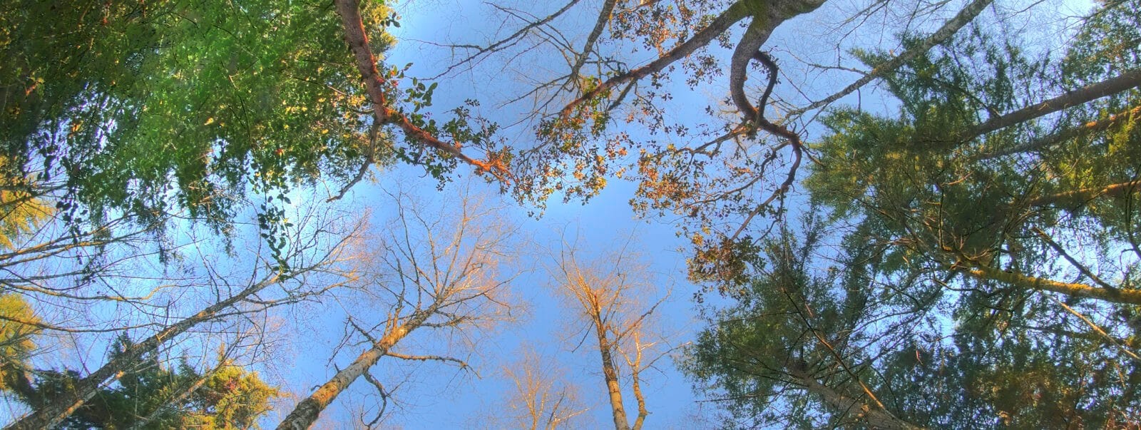
Early morning sun burnishes the wing strokes of a flock of Canada geese. Their honking heralds my arrival at a small meadow festooned with the giddy weavings of a thousand spiders. Before me lies the childhood haunt of Charles Howe and Eleanor Long, who have protected this corner of Henderson Inlet with a conservation easement in memory of their parents. I make my way across the meadow, and enter a shadowed forest. Great boughs droop from cedar trees and the trunks of fir and maple soar into the forest canopy. Beyond, I glimpse Dobbs Creek wandering over mudflats exposed by low tide. Salmonberry and devils club choke a wide depression in the forest and rich black mud forces a detour in my path. The depression and the mud cradle a spring; just downhill the mud releases its moisture in little rills that gather in a small stream spilling to the bay. The stream carves a sinuous path through mudflats, until its fresh water meets the salt of the turning tide. It’s an understated meeting, but one of great significance, for the convergence of fine organic forest material carried by streams and the nutrients flowing with the incoming tide creates the estuary – a habitat nearly unrivaled for productivity.

The mudflats of this estuary create a shining expanse when the tide empties Henderson Inlet and the mouth of Dobbs Creek. I cannot see the abundance of life in the mud – the mollusks and worms, or the microbes feeding on decaying organic matter. But I know it’s there, for shorebirds comb the mud with their beaks while mallards and green-winged teals dabble along the edges. Seven double-crested cormorants stand at water’s edge with beaks tilted up and wings spread to dry. Another dives in the shallow waters of the bay for the small fish that thrive in plankton-rich water. The rising tide slips across the flats, rearranging muddy expanses into ever smaller shapes. A flock of bufflehead sails by; I watch their striking black and white forms and then turn away from the inlet. Madrone trees add their sculpted forms to the forest, and a large bitter cherry towers near the western shore. Beneath it a host of young cherries form a moss-floored glade, like a secret opening in the tangle of undergrowth. Kinglets and song sparrows chatter among the branches, but they are mere echoes of the bird life that abounds here during nesting season.

A second depression holds another spring, and a slightly larger stream flows to the bay. A hollow maple stands on the bank, its huge cavity filled with the dusky ruffles of a mushroom colony and the earthy scent of slowly rotting wood. It won’t be long before the tree topples and adds its bulk to the other woody debris on this wild bit of shore.

I know baseline studies have documented the value of this property for wildlife. But how do you measure the ambiguities of mud slumping in spring-fed depressions in the forest and basking under open skies in the tideflats? How many chum and coho slip by uncounted in the murk of a rising tide? What hidden profusions of fungus grow in the forest floor? How many seeds lie dormant in the meadow? When the Trust protects places like the Howe property, perhaps its what we don’t know about them that is most important; and perhaps this is their real value for future generations.

  • Facebook
  • Instragram
  • Youtube

  • PO Box 14065
  • Tumwater, WA 98511
  • Telephone: (360) 943-3012
  • Email:

  • Who We Are
  • Our Mission
  • Board & Staff
  • Collaboration
  • Financials
  • Library
  • Careers
  • Get Involved
  • Trail Steward
  • Stewardship Work Parties
  • Salmon Docent
  • K-12 Outdoor Programs
  • Ways To Give
  • Cash
  • Other Ways to Give
  • Become a Business Partner
  • Gifts of Land
  • Bequests, Estate Plans & Wills
  • Stocks, Donor Advised Funds, IRAs
  • Conserved Lands
  • Conservation Map
  • Conserving Key Habitats
  • Conservation Areas
  • Conserve Your Land
  • Visit A Preserve
  • Inspiring Kids Preserve
  • Managing Our Preserves
  • Donate
  • Contact
  • Events
  • News

Copyright © Capitol Land Trust All Rights Reserved. | Made by SlowClouds