• Donate
  • Contact
  • Facebook
  • Instagram
  • YouTube
menu
  • Visit A Preserve
  • Who We Are
    • Our Mission
    • Board & Staff
    • Collaboration
    • Financials
    • Library
  • Get Involved
    • Trail Steward
    • Salmon Docent
    • Stewardship Work Parties
    • K-12 Outdoor Programs
  • Ways To Give
    • Cash
    • Stocks, Donor Advised Funds, IRAs
    • Bequests, Estate Plans & Wills
    • Gifts of Land
    • Other Ways to Give
    • Become a Business Partner
  • Conserved Lands
    • Conservation Map
    • Conserving Key Habitats
    • Conservation Areas
      • Budd & Henderson Inlets
        • Bayfield Resource Co. Forest Conservation Easement
        • Bayfield Resource Co. Gull Harbor Conservation Easement
        • Brown Preserve
        • Cushman Conservation Easement
        • Hale Preserve
        • Harmony Farm Preserve
        • Howe Conservation Easement
        • Lonseth Preserve
        • Scheidt-Mayer Conservation Easement
        • Stephens Preserve
        • Woodland Creek
      • Black River / Chehalis Watershed
        • Aldridge Conservation Easement
        • Baretich Conservation Easement
        • Bergquist Conservation Easement
        • Black River Conservation Easement and Preserve
        • Darlin Creek Preserve
        • Davis Conservation Easement
        • Decker Creek Wetland Complex
        • DeFelice Preserve
        • Edwards Conservation Easement
        • Gordon Farm Conservation Easement
        • Heertje Conservation Easement
        • Holm-Rader Farm Conservation Easement
        • Leitner Prairie Conservation Easements
        • Tilley Wetlands Preserve
        • West Rocky Prairie
      • Cowlitz Watershed
        • Cowlitz River Preserve
      • Deschutes Watershed
        • Anderson Preserve
        • Bentley Conservation Easement
        • Bush Prairie Farm Conservation Easement
        • Parsons Family Farm Conservation Easement
        • Shermer-Deschutes Preserve
        • Springer Lake Preserve
        • Spurgeon Valley Preserve
        • Stewart Conservation Easement
        • Stewart-Deschutes Preserve
        • Yale Preserve
      • Green Cove Creek Wetlands
        • Harper Conservation Easement
        • Kaiser Preserve
        • LOTT Alliance Conservation Easement
        • Ekar-Overhulse Preserve
        • Paul-Leigh Conservation Easement
        • SPSCC Foundation Property
        • YWCA
      • Hood Canal
        • Brothers Beach Conservation Easement
      • Oakland Bay & Goldsborough Creek Watershed
        • Bayshore Preserve
        • Granquist Preserve
        • Hilburn Preserve
        • North Fork Goldsborough Creek Preserve
        • Oakland Bay Historical Park Conservation Easement
        • Olli Conservation Easement
        • Pannell Preserve
        • Rose Preserve
        • North Fork Goldsborough Creek Preserve – Rose Addition
        • Sunset Bluffs
        • Twin Rivers Ranch Preserve
      • Steamboat Conservation Partnership Region
        • Adams Cove Preserve
        • Appleby Conservation Easement
        • Davidson-Bergman Conservation Easement
        • Lower Eld Preserve
        • McIntyre Conservation Easement
        • McLane Point Preserve/Conservation Easement
        • Randall Preserve / Allison Springs
        • Schmidt Conservation Easements
        • Triple Creek Farm Conservation Easement
        • Willits Conservation Easement
        • Willits Tree Farm Conservation Easement
        • Wynne Tree Farm Conservation Easements
    • Inspiring Kids Preserve
    • Conserve Your Land
    • Managing Our Preserves
  • News
  • Events
  • Donate
  • Contact
  • Visit A Preserve
  • Who We Are
    • Our Mission
    • Board & Staff
    • Collaboration
    • Financials
    • Library
  • Get Involved
    • Trail Steward
    • Salmon Docent
    • Stewardship Work Parties
    • K-12 Outdoor Programs
  • Ways To Give
    • Cash
    • Stocks, Donor Advised Funds, IRAs
    • Bequests, Estate Plans & Wills
    • Gifts of Land
    • Other Ways to Give
    • Become a Business Partner
  • Conserved Lands
    • Conservation Map
    • Conserving Key Habitats
    • Conservation Areas
      • Budd & Henderson Inlets
        • Bayfield Resource Co. Forest Conservation Easement
        • Bayfield Resource Co. Gull Harbor Conservation Easement
        • Brown Preserve
        • Cushman Conservation Easement
        • Hale Preserve
        • Harmony Farm Preserve
        • Howe Conservation Easement
        • Lonseth Preserve
        • Scheidt-Mayer Conservation Easement
        • Stephens Preserve
        • Woodland Creek
      • Black River / Chehalis Watershed
        • Aldridge Conservation Easement
        • Baretich Conservation Easement
        • Bergquist Conservation Easement
        • Black River Conservation Easement and Preserve
        • Darlin Creek Preserve
        • Davis Conservation Easement
        • Decker Creek Wetland Complex
        • DeFelice Preserve
        • Edwards Conservation Easement
        • Gordon Farm Conservation Easement
        • Heertje Conservation Easement
        • Holm-Rader Farm Conservation Easement
        • Leitner Prairie Conservation Easements
        • Tilley Wetlands Preserve
        • West Rocky Prairie
      • Cowlitz Watershed
        • Cowlitz River Preserve
      • Deschutes Watershed
        • Anderson Preserve
        • Bentley Conservation Easement
        • Bush Prairie Farm Conservation Easement
        • Parsons Family Farm Conservation Easement
        • Shermer-Deschutes Preserve
        • Springer Lake Preserve
        • Spurgeon Valley Preserve
        • Stewart Conservation Easement
        • Stewart-Deschutes Preserve
        • Yale Preserve
      • Green Cove Creek Wetlands
        • Harper Conservation Easement
        • Kaiser Preserve
        • LOTT Alliance Conservation Easement
        • Ekar-Overhulse Preserve
        • Paul-Leigh Conservation Easement
        • SPSCC Foundation Property
        • YWCA
      • Hood Canal
        • Brothers Beach Conservation Easement
      • Oakland Bay & Goldsborough Creek Watershed
        • Bayshore Preserve
        • Granquist Preserve
        • Hilburn Preserve
        • North Fork Goldsborough Creek Preserve
        • Oakland Bay Historical Park Conservation Easement
        • Olli Conservation Easement
        • Pannell Preserve
        • Rose Preserve
        • North Fork Goldsborough Creek Preserve – Rose Addition
        • Sunset Bluffs
        • Twin Rivers Ranch Preserve
      • Steamboat Conservation Partnership Region
        • Adams Cove Preserve
        • Appleby Conservation Easement
        • Davidson-Bergman Conservation Easement
        • Lower Eld Preserve
        • McIntyre Conservation Easement
        • McLane Point Preserve/Conservation Easement
        • Randall Preserve / Allison Springs
        • Schmidt Conservation Easements
        • Triple Creek Farm Conservation Easement
        • Willits Conservation Easement
        • Willits Tree Farm Conservation Easement
        • Wynne Tree Farm Conservation Easements
    • Inspiring Kids Preserve
    • Conserve Your Land
    • Managing Our Preserves
  • News
  • Events

Camera Photo by Kay Schultz

  • ShareShare this post on Facebook
  • Share this post on FacebookTweet
Land Trust Accreditation Commission
Donate Today

Learn More About Us

  • Conserved Lands
  • Conservation Map
  • Conserving Key Habitats
  • Conservation Areas
  • Conserve Your Land
  • Visit A Preserve
  • Inspiring Kids Preserve
  • Managing Our Preserves

Lonseth Preserve

Conserved in 2011

Property Overview

  • 60 acres located off Zangle Road, near Capitol Land Trust’s Bayfield Resources Company Forest Conservation Easement in northern Thurston County.
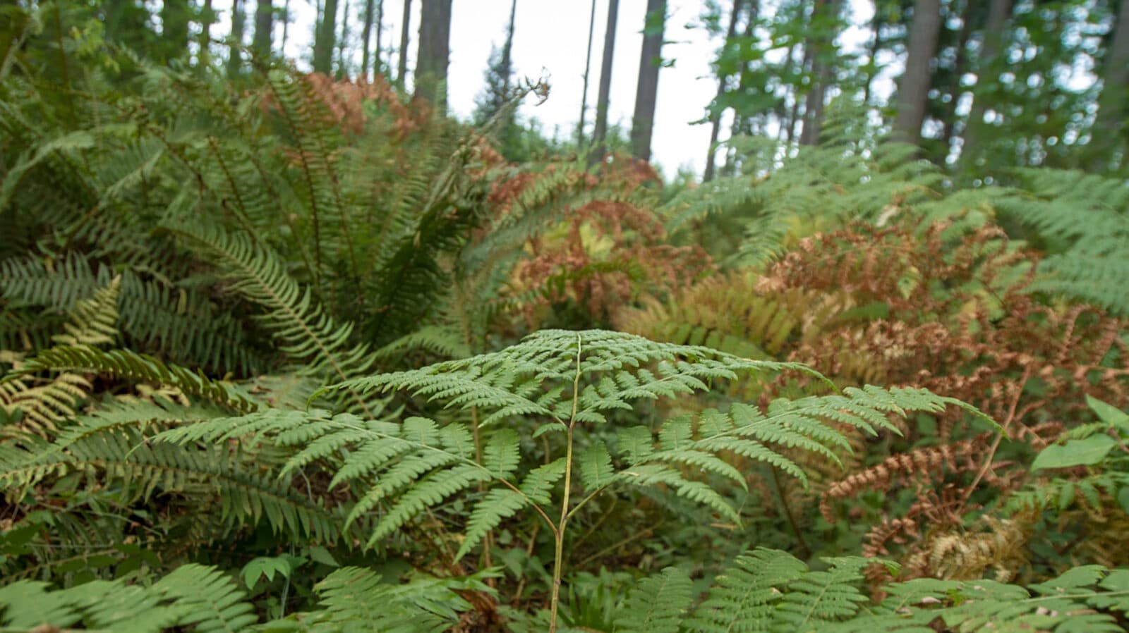
  • The Lonseth Preserve is almost entirely composed of wetland and associated wetland riparian forest, with second-growth forests roughly 65 years old.
  • The property is part of a larger initiative, the Budd to Henderson Coastal Conservation Initiative. The goal is to create an overland corridor to connect the Gull Harbor estuary on Budd Inlet and the Woodard Bay estuary on Henderson Inlet.

Thank you to the following partners:

  • Elizabeth and Stan Lonseth
  • ADESA Environmental
  • Pacific Northwest Forestry LLC

CLT Strategic Conservation Goal Achieved:

  • Conserve wetlands, riparian areas and associated upland forests.


Budd to Henderson Coastal Conservation Initiative:
Newest Acquisition a Major Milestone

by Steve Kelso (Fall 2012)

In November 2011, Capitol Land Trust purchased the Lonseth property, a 60-acre parcel on the peninsula north of Olympia between Budd Inlet and Henderson Inlet. Purchase of this property is part of a larger strategic plan, the Budd to Henderson Coastal Conservation Initiative, which began in 2005 and has already conserved a majority of the Gull Harbor estuary, the most naturally intact estuary within the Budd Inlet watershed. The long-term goal of the initiative is to establish a protected overland corridor between Gull Harbor to the west and the Woodard Bay/Chapman Cove estuarine complex on Henderson Inlet, to the east.

The Lonseth property is a rectangle at the north end of the project area boundary. The site contains important forested and open-water wetlands that drain to both the Woodard Bay Natural Resource Conservation Area and into Gull Harbor. While it’s unlikely that aquatic organisms could purposefully or in some serendipitous manner make the overland passage between the two inlets, creation of an overland corridor for mammals and birds offers an intriguing metaphor for the connections and links Capitol Land Trust makes—connections that allow natural functions to proceed and evolve in a healthy and vital, though not always predictable, manner.

Looking at a map, it is easy to imagine the free movement of land creatures along the corridor between Gull Harbor and Woodard Bay, unimpeded by major human interference. Only two main roads cross this corridor—Boston Harbor Road and Libby Road. This lowland landscape looks remarkably similar to the way it was after the retreat of the ice-age glaciers that scoured the region thousands of years ago.

The geology of the property is entirely glacial silt, mostly Vashon till, which was deposited when glacial fingers of the western ice sheet reached their southern limit in what is now the southern Puget Sound region.

The property’s habitat appears to support a number of important species including bald eagle, great blue heron, pileated woodpecker, and purple martin. Red-tailed hawk, bufflehead, mallard, common goldeneye, surf scoter, cormorant, Yuma myotis, black-tailed deer, raccoon, Canada goose, Harlequin duck, kingfisher, turkey vulture, weasel, frogs and salamanders have also been seen.

Vegetation on the property consists of upland forest, riparian habitat, and a variety of wetland habitats. Douglas-fir is the primary tree species. The forest understory is dominated by salal, sword fern, Oregon grape, and several varieties of huckleberry, with smaller amounts of oceanspray, salmonberry, red elderberry, and Indian plum scattered throughout. Along the open water wetland/riparian fringe and in the forested wetlands, common plant species include red alder, Indian plum, spirea, creeping buttercup, slough sedge, Arctic sweet coltsfoot, giant horsetail, lady fern, devil’s club, red-flowering currant, maidenhair fern, large-leaved avens, swamp rose, and salmonberry.

The Lonseth family managed the property for sustainable timber production from 1967 until Capitol Land Trust purchased the property. Salvage, thinning and replanting activities have been carried out intermittently on parcels of the family’s tree farm since 1991.

Capitol Land Trust’s overall timber management goal for this property is to maintain forest health and achieve old-growth forest characteristics with well spaced, large-diameter climax species such as Douglas fir and Western redcedar with an open forest floor dominated by red and evergreen huckleberries, sword and bracken ferns, salal, and Oregon grape. The Land Trust is evaluating management strategies to achieve this goal.

The Lonseth acquisition and the larger Budd to Henderson Conservation Initiative provide an excellent opportunity to preserve intact habitat that no longer exists in much of the southern Puget Sound region. The project will help to permanently conserve an important landscape-scale riparian habitat system, including freshwater streams, seeps, springs, forested wetlands, and Puget Sound’s coastal shorelines, safeguarding water quality and flow into Budd and Henderson Inlets.

Thank You Project Partners: Squaxin Island Tribe, U.S. Environmental Protection Agency, WA State Department of Natural Resources, LOTT Clean Water Alliance, WA State Recreation and Conservation Office, WA State Salmon Recovery Funding Board, Thurston County, Wild Fish Conservancy, Washington State University, Forterra (Cascade Land Conservancy), Bayfield Resources Company, The Cushman family, Elizabeth and Stan Lonseth.

  • Facebook
  • Instragram
  • Youtube

  • PO Box 14065
  • Tumwater, WA 98511
  • Telephone: (360) 943-3012
  • Email:

  • Who We Are
  • Our Mission
  • Board & Staff
  • Collaboration
  • Financials
  • Library
  • Careers
  • Get Involved
  • Trail Steward
  • Stewardship Work Parties
  • Salmon Docent
  • K-12 Outdoor Programs
  • Ways To Give
  • Cash
  • Other Ways to Give
  • Become a Business Partner
  • Gifts of Land
  • Bequests, Estate Plans & Wills
  • Stocks, Donor Advised Funds, IRAs
  • Conserved Lands
  • Conservation Map
  • Conserving Key Habitats
  • Conservation Areas
  • Conserve Your Land
  • Visit A Preserve
  • Inspiring Kids Preserve
  • Managing Our Preserves
  • Donate
  • Contact
  • Events
  • News

Copyright © Capitol Land Trust All Rights Reserved. | Made by SlowClouds