Hilburn Preserve
Visit a Capitol Land Trust trail! Our four public-access preserve are free to use and do not require a pass. Please Leave No Trace when visiting a preserve, including taking all garbage with you when you leave, respecting wildlife, and leaving what you find. There are no garbage cans at any preserve and no bathrooms at Randall and Hilburn preserves. There is a portable toilet at Bayshore Preserve and Darlin Creek Preserve. We hope you enjoy your walk at one of our preserves as much as we enjoy protecting them! If you have questions, comments, or concerns, please email [email protected].
Conserved in 2010
Property Overview:
- 10 acres on Goldsborough Creek, just outside Shelton in Mason County
- Intact forested riparian buffer and instream habitat
- Migratory corridor for coho and fall chum salmon, winter steelhead, and both resident and anadromous cutthroat trout, and anadromous Pacific lamprey
- Check out Hilburn Preserve birding hotspot on eBird
Thank you to the following partners:
- Scott Hilburn and the Hilburn family
- Squaxin Island Tribe
- U.S. Environmental Protection Agency Region 10
- WA State Recreation and Conservation Office – Salmon Recovery Funding Board
CLT Strategic Conservation Goal Achieved:
- Conserve wetlands, riparian areas and associated wetlands.
Capitol Land Trust is the owner of this nearly 10 acres of important riparian and instream habitat just below the old Goldsborough Dam site.
The Goldsborough Dam was removed in 2001 opening up 25 miles of stream channel to fish access. The property purchased by Capitol Land Trust forms a high quality, migratory corridor for several salmon species, providing access upstream to this new, very productive habitat. More than 2/3 of the coho in the system now spawn past the property and into the upper watershed. Since the dam was removed, coho smolt production has increased from a few thousand per year to tens of thousands per year.
The property is directly adjacent to a 60-acre property owned by Green Diamond Resource Company and just downstream of two other Capitol Land Trust sites. Together these parcels form a large complex of conserved property at a critical juncture in the watershed.
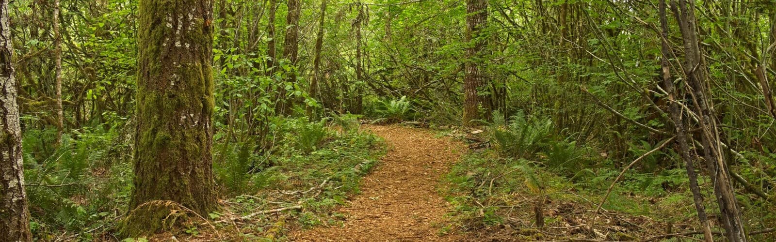
Hilburn Preserve Trail
Plan a visit to Hilburn Preserve to enjoy the scenery and wildlife!
Guidelines:
Open from dawn till dusk.
Keep pets on leash and dispose of waste properly.
No hunting, fires/fireworks, camping or motorized vehicles.
No removal of vegetation or mushrooms.
Stay on designated trails.
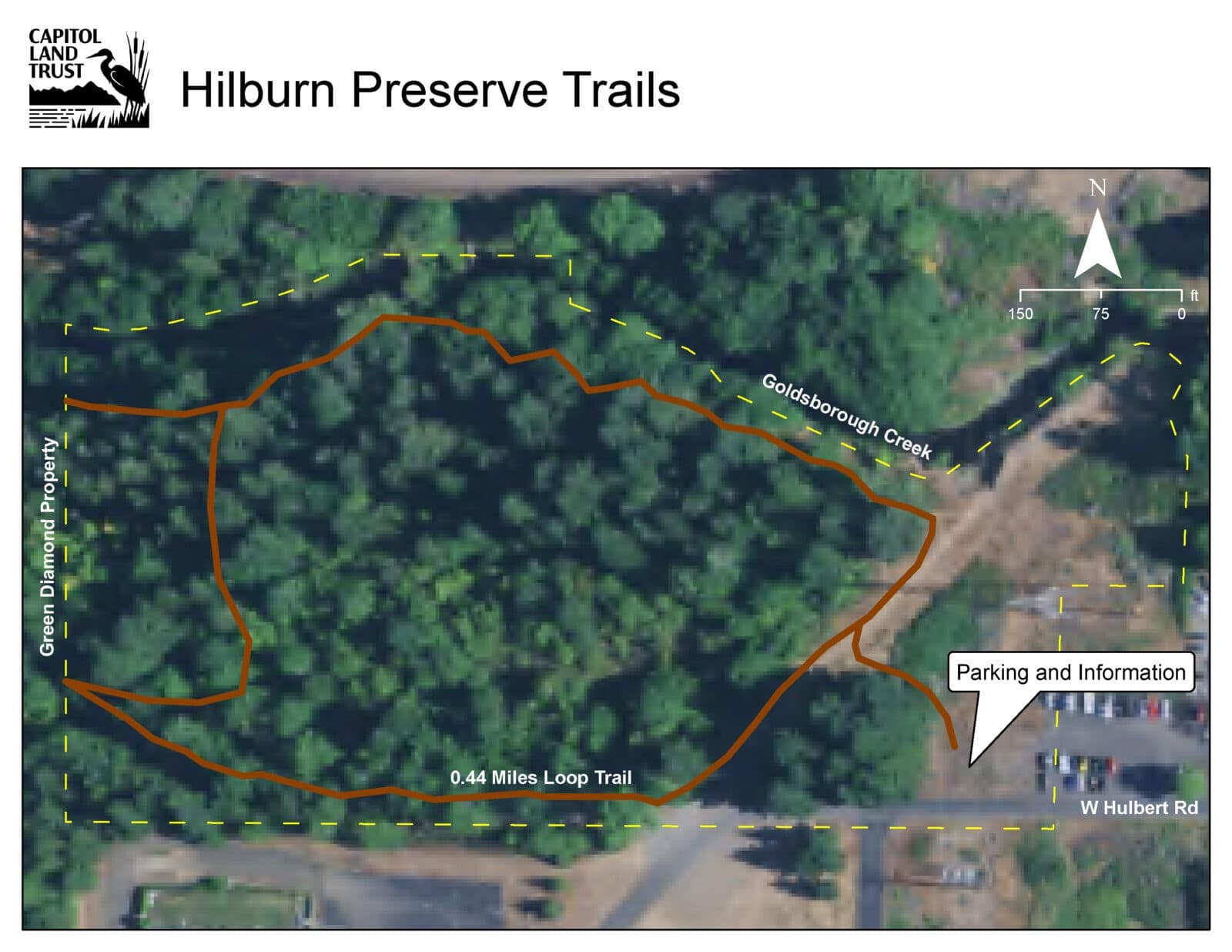
Location: W Hulbert Road Shelton, WA 98584. Free parking is available at the site.
Bathroom Information: There is no bathroom at Hilburn Preserve.
Trail Information: Hilburn Preserve Trail Map
The trail is approximately 0.5 miles and varies between mulch, dirt, and gravel. The trail starts relatively flat, but has several small sets of steps to help visitors navigate the elevation changes. There are three benches along the trail closest to Goldsborough Creek.
Want to help us care for this preserve? Check out our Trail Steward volunteer opportunity or fill out a short trail report!