Sunset Bluffs
Preserved in 2012
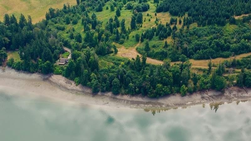
Property Overview:
- This 36.5 property was conserved with Capitol Land Trust’s assistance by Mason County Parks and the Trust for Public Lands. The pristine nature of the habitat at Sunset Bluffs made it a top priority for many groups.
- The Sunset Bluffs property contains 1,500 feet of natural shoreline, 10 acres of marine riparian habitat, 4 acres of stream riparian habitat, and 22 acres of upland forests and open areas.
- Preserving the ecological functions and habitat at Sunset Bluffs was vital for maintaining and improving water quality in Oakland Bay.
Thank you to the following partners:
- The Trust for Public Lands
- Mason County Parks and Trails Department
CLT Strategic Conservation Goals Achieved:
- Conserve wetlands, riparian areas, and associated upland forests.
- Conserve marine estuaries and shorelines.