• Connecting to the Land Campaign
  • Donate
  • Contact
  • Facebook
  • Instagram
  • YouTube
menu
  • Connecting to the Land Campaign
  • Visit A Preserve
    • Bayshore Preserve Reopens
  • Who We Are
    • Our Mission
    • Board & Staff
    • Collaboration
    • Financials
    • Library
  • Conserved Lands
    • Conservation Map
    • Conserving Key Habitats
    • Conservation Areas
      • Budd & Henderson Inlets
        • Bayfield Resource Co. Forest Conservation Easement
        • Bayfield Resource Co. Gull Harbor Conservation Easement
        • Brown Preserve
        • Cushman Conservation Easement
        • Hale Preserve
        • Harmony Farm Preserve
        • Howe Conservation Easement
        • Lonseth Preserve
        • Scheidt-Mayer Conservation Easement
        • Stephens Preserve
        • Woodland Creek
      • Black River / Chehalis Watershed
        • Aldridge Conservation Easement
        • Baretich Conservation Easement
        • Bergquist Conservation Easement
        • Black River Conservation Easement and Preserve
        • Darlin Creek Preserve
        • Davis Conservation Easement
        • Decker Creek Wetland Complex
        • DeFelice Preserve
        • Edwards Conservation Easement
        • Gordon Farm Conservation Easement
        • Heertje Conservation Easement
        • Holm-Rader Farm Conservation Easement
        • Leitner Prairie Conservation Easements
        • Tilley Wetlands Preserve
        • West Rocky Prairie
      • Cowlitz Watershed
        • Cowlitz River Preserve
      • Deschutes Watershed
        • Anderson Preserve
        • Bentley Conservation Easement
        • Bush Prairie Farm Conservation Easement
        • Parsons Family Farm Conservation Easement
        • Shermer-Deschutes Preserve
        • Springer Lake Preserve
        • Spurgeon Valley Preserve
        • Stewart Conservation Easement
        • Stewart-Deschutes Preserve
        • Yale Preserve
      • Green Cove Creek Wetlands
        • Harper Conservation Easement
        • Kaiser Preserve
        • LOTT Alliance Conservation Easement
        • Ekar-Overhulse Preserve
        • Paul-Leigh Conservation Easement
        • SPSCC Foundation Property
        • YWCA
      • Hood Canal
        • Brothers Beach Conservation Easement
      • Oakland Bay & Goldsborough Creek Watershed
        • Bayshore Preserve
        • Granquist Preserve
        • Hilburn Preserve
        • North Fork Goldsborough Creek Preserve
        • Oakland Bay Historical Park Conservation Easement
        • Olli Conservation Easement
        • Pannell Preserve
        • Rose Preserve
        • North Fork Goldsborough Creek Preserve – Rose Addition
        • Sunset Bluffs
        • Twin Rivers Ranch Preserve
      • Steamboat Conservation Partnership Region
        • Adams Cove Preserve
        • Appleby Conservation Easement
        • Davidson-Bergman Conservation Easement
        • Lower Eld Preserve
        • McIntyre Conservation Easement
        • McLane Point Preserve/Conservation Easement
        • Randall Preserve / Allison Springs
        • Schmidt Conservation Easements
        • Triple Creek Farm Conservation Easement
        • Willits Conservation Easement
        • Willits Tree Farm Conservation Easement
        • Wynne Tree Farm Conservation Easements
    • Inspiring Kids Preserve
    • Conserve Your Land
    • Managing Our Preserves
  • News
  • Events
  • Ways To Give
    • Cash
    • Stocks, Donor Advised Funds, IRAs
    • Bequests, Estate Plans & Wills
    • Gifts of Land
    • Other Ways to Give
    • Become a Business Partner
  • Donate
  • Contact
  • Connecting to the Land Campaign
  • Visit A Preserve
    • Bayshore Preserve Reopens
  • Who We Are
    • Our Mission
    • Board & Staff
    • Collaboration
    • Financials
    • Library
  • Conserved Lands
    • Conservation Map
    • Conserving Key Habitats
    • Conservation Areas
      • Budd & Henderson Inlets
        • Bayfield Resource Co. Forest Conservation Easement
        • Bayfield Resource Co. Gull Harbor Conservation Easement
        • Brown Preserve
        • Cushman Conservation Easement
        • Hale Preserve
        • Harmony Farm Preserve
        • Howe Conservation Easement
        • Lonseth Preserve
        • Scheidt-Mayer Conservation Easement
        • Stephens Preserve
        • Woodland Creek
      • Black River / Chehalis Watershed
        • Aldridge Conservation Easement
        • Baretich Conservation Easement
        • Bergquist Conservation Easement
        • Black River Conservation Easement and Preserve
        • Darlin Creek Preserve
        • Davis Conservation Easement
        • Decker Creek Wetland Complex
        • DeFelice Preserve
        • Edwards Conservation Easement
        • Gordon Farm Conservation Easement
        • Heertje Conservation Easement
        • Holm-Rader Farm Conservation Easement
        • Leitner Prairie Conservation Easements
        • Tilley Wetlands Preserve
        • West Rocky Prairie
      • Cowlitz Watershed
        • Cowlitz River Preserve
      • Deschutes Watershed
        • Anderson Preserve
        • Bentley Conservation Easement
        • Bush Prairie Farm Conservation Easement
        • Parsons Family Farm Conservation Easement
        • Shermer-Deschutes Preserve
        • Springer Lake Preserve
        • Spurgeon Valley Preserve
        • Stewart Conservation Easement
        • Stewart-Deschutes Preserve
        • Yale Preserve
      • Green Cove Creek Wetlands
        • Harper Conservation Easement
        • Kaiser Preserve
        • LOTT Alliance Conservation Easement
        • Ekar-Overhulse Preserve
        • Paul-Leigh Conservation Easement
        • SPSCC Foundation Property
        • YWCA
      • Hood Canal
        • Brothers Beach Conservation Easement
      • Oakland Bay & Goldsborough Creek Watershed
        • Bayshore Preserve
        • Granquist Preserve
        • Hilburn Preserve
        • North Fork Goldsborough Creek Preserve
        • Oakland Bay Historical Park Conservation Easement
        • Olli Conservation Easement
        • Pannell Preserve
        • Rose Preserve
        • North Fork Goldsborough Creek Preserve – Rose Addition
        • Sunset Bluffs
        • Twin Rivers Ranch Preserve
      • Steamboat Conservation Partnership Region
        • Adams Cove Preserve
        • Appleby Conservation Easement
        • Davidson-Bergman Conservation Easement
        • Lower Eld Preserve
        • McIntyre Conservation Easement
        • McLane Point Preserve/Conservation Easement
        • Randall Preserve / Allison Springs
        • Schmidt Conservation Easements
        • Triple Creek Farm Conservation Easement
        • Willits Conservation Easement
        • Willits Tree Farm Conservation Easement
        • Wynne Tree Farm Conservation Easements
    • Inspiring Kids Preserve
    • Conserve Your Land
    • Managing Our Preserves
  • News
  • Events
  • Ways To Give
    • Cash
    • Stocks, Donor Advised Funds, IRAs
    • Bequests, Estate Plans & Wills
    • Gifts of Land
    • Other Ways to Give
    • Become a Business Partner

News
September 21, 2026

Hudson Cove Conservation Easement Protects a Rare Pocket Estuary on Totten Inlet

CameraHudson Cove Conservation Easement protects 218 acres of estuary, salt and freshwater wetlands, and forested upland habitat, Mike Melton.

  • ShareShare this post on Facebook
  • Share this post on FacebookTweet
Land Trust Accreditation Commission
Donate Today

Learn More About Us

  • Conserved Lands
  • Conservation Map
  • Conserving Key Habitats
  • Conservation Areas
  • Conserve Your Land
  • Visit A Preserve
  • Inspiring Kids Preserve
  • Managing Our Preserves

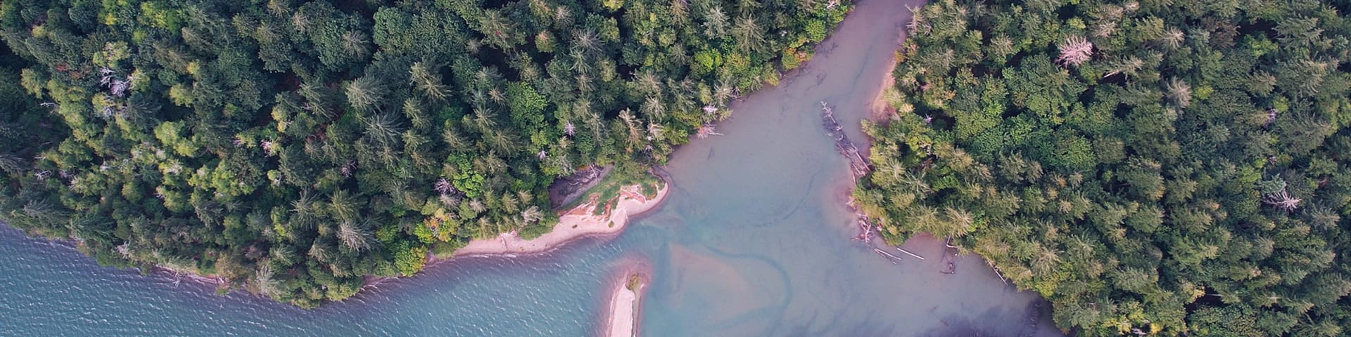
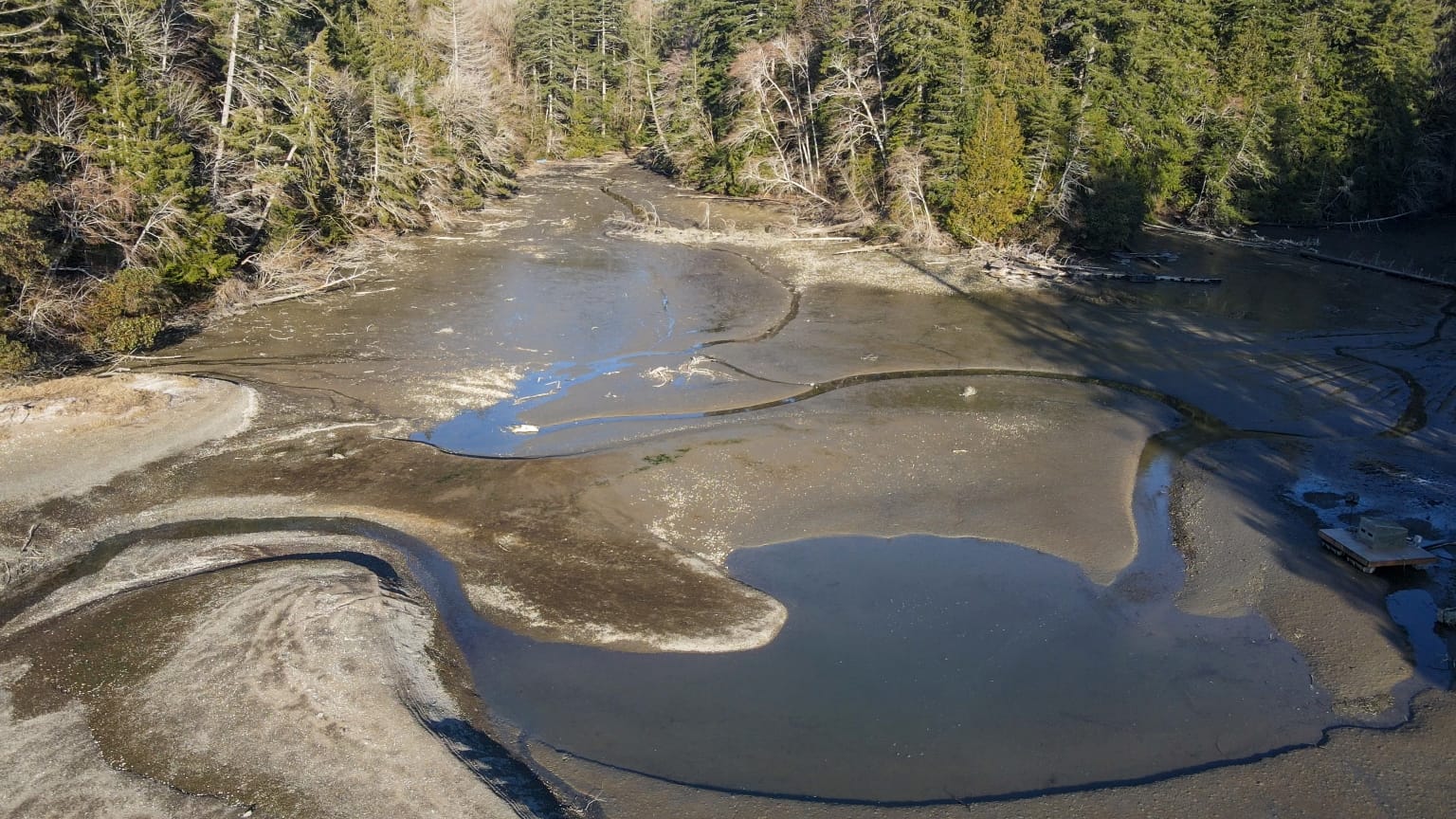
Nestled along the shoreline of the Steamboat Peninsula in northwest Thurston County is one of the rarest and most valuable habitats in the South Puget Sound: a 7.8-acre pocket estuary known as Hudson Cove. This sheltered area where fresh and salt water meet provides an important place for salmon to take refuge as they prepare to journey into deeper waters. Now, thanks to the generous support of many Capitol Land Trust partners, this critical marine habitat has been permanently protected, along with the tidelands, wetlands, salt marsh, and mixed conifer forest that make up the 218-acre Hudson Cove Conservation Easement.

“If you look at an aerial image of the Steamboat Peninsula, there’s no other place with 200-plus acres of undeveloped land,” explains Senior Land Projects Manager Laurence Reeves. “Though increasingly rarer to find, these bigger parcels have more conservation value in terms of habitat connectivity and the biodiversity associated with that.”

The easement protects more than 2.5 miles of combined marine and freshwater shoreline, including 8,500 feet along Totten Inlet and 4,745 feet of perennial and seasonal streams. This brings Capitol Land Trust’s total length of protected Puget Sound shoreline to more than 20 miles, a true milestone in the history of our organization.

Why Pocket Estuaries Matter

Estuaries provide a rich and protected environment where young fish like salmon prepare for life at sea during what is a particularly vulnerable time in their development. Pocket estuaries like Hudson Cove provide the salmon with a safe place to adjust to salt water gradually, hidden from predators among overhanging shoreline vegetation. This allows them the time needed to take advantage of abundant food resources, which in turn leads to rapid growth and the strength they need for their next phase of life.

The Hudson Cove Conservation Easement not only directly prevents the loss of this scare and critical habitat, it also indirectly benefits the estuary by preventing the pollution and runoff that would have occurred if the site had been developed instead of protected.

The 7.8-acre pocket estuary known as Hudson Cove is important habitat for salmon, Mike Melton.
A Haven for Wildlife

Hudson Cove provides habitat for five salmonid species — Chinook salmon, steelhead, coho salmon, coastal cutthroat trout, and chum salmon — several of whom are federally listed as threatened. The site’s marine waters are also federally recognized as critical habitat for Southern Resident orcas, who rely on healthy salmon runs for food.

Totten Inlet is one of the most significant shorebird areas in the inland marine waters of Washington state, supporting some of the largest estuarine shorebird flocks in south and central Puget Sound. Hudson Cove boasts salt marsh and mud flat habitat which provide important nesting and foraging habitat for shorebirds and waterfowl. More than 100 migratory and resident bird species use the property, including bald eagles, peregrine falcons, purple martins, kingfishers, and great blue herons. The site also lies within flight range of the marbled murrelet, a federally threatened species.

The property’s nearshore waters are home to numerous crustacean and mollusk species, including crabs, clams, mussels, and oysters. Olympia oysters were historically abundant along the property’s shoreline, which is lined by high feeder bluffs that provide habitat for the giant chain fern, a state-sensitive plant species. Such feeder bluffs are becoming increasingly rare in the southern Puget Sound region, yet another reason why conserving this property, one of the largest remaining undeveloped areas on the peninsula, is so important.

A Forest That Connects Land and Water
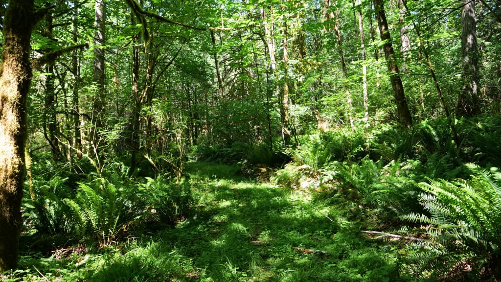

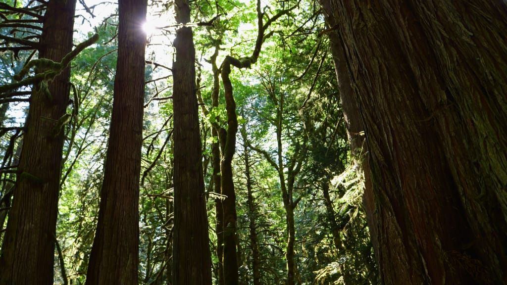
Approximately 200 acres of native forest — including western redcedar, western hemlock, Douglas-fir, Sitka spruce, Pacific madrone, bigleaf maple, and red alder — mark the transition between water and land. The forested area contains riparian habitat, mature cedar groves, and stands that were harvested more recently. These forests help filter sediment, moderate water temperature, and stabilize the shoreline, all of which support the fish and other wildlife who depend on Hudson Cove.

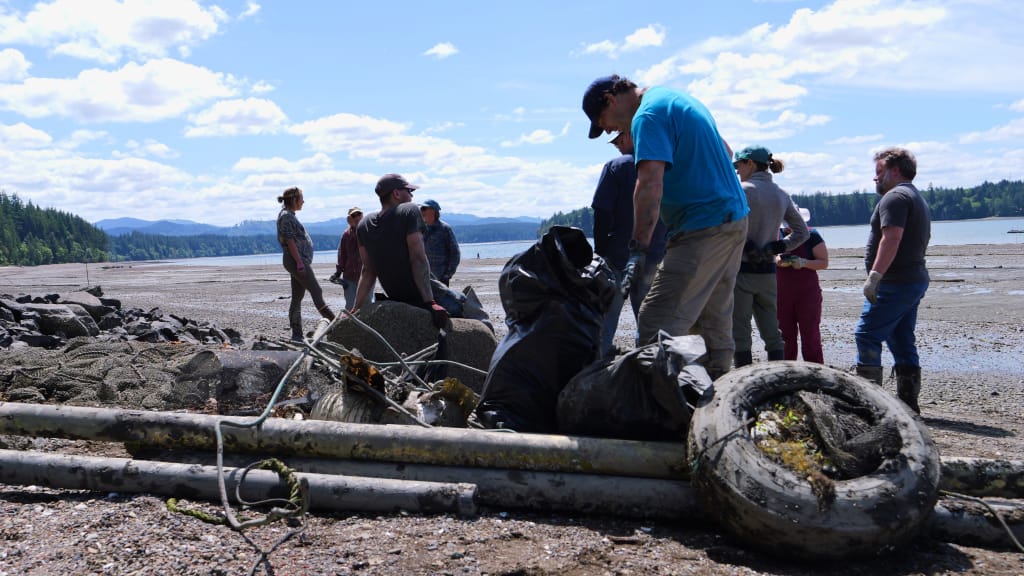
As part of our stewardship of the property, we’ve already begun to remove accumulated debris such as plastic barrels and netting that has washed into the pocket estuary and shoreline over the years. Such stewardship efforts will help ensure both land and water remain healthy for generations to come.
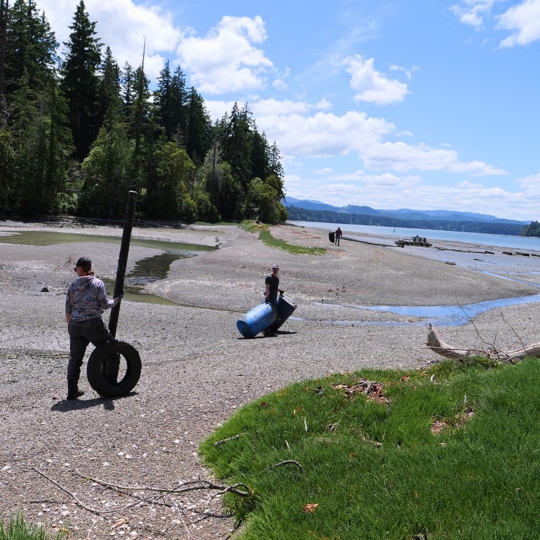
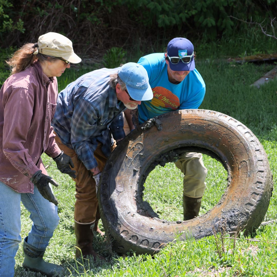
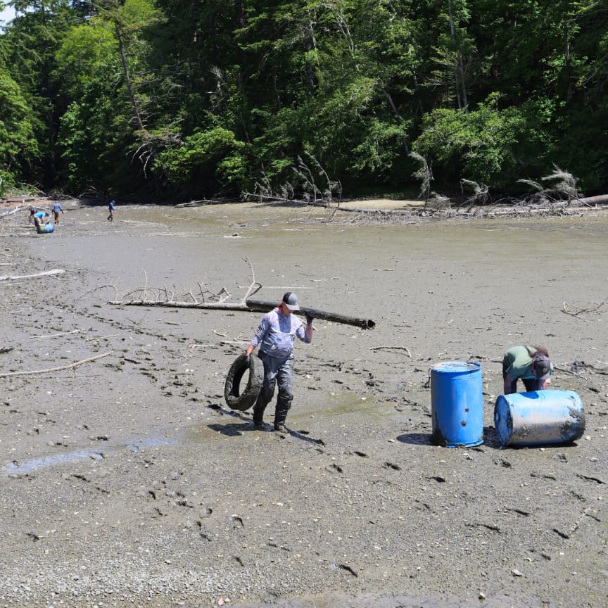
In June 2026, we teamed up with the U.S. Fish and Wildlife Service to clean up the beach and estuary of Hudson Cove.
Building a Stronger Network of Conservation

The Hudson Cove Conservation Easement builds on our earlier work at Adams Cove Preserve, which protects another Totten Inlet pocket estuary and 1,400 feet of marine shoreline nearby. It also directly supports the Washington State Department of Natural Resources’ Kennedy Creek Natural Resources Conservation Area, which protects 1,110 acres of riparian habitat along Kennedy Creek, Totten Inlet’s main tributary and home to one of the region’s most prolific fall chum runs.

Juvenile salmon migrating out from Kennedy Creek rely on Hudson Cove as an important refuge. Together, these connected places give salmon a continuous corridor of resting and rearing habitat as they move toward the deeper waters of the Sound and Pacific Ocean beyond.

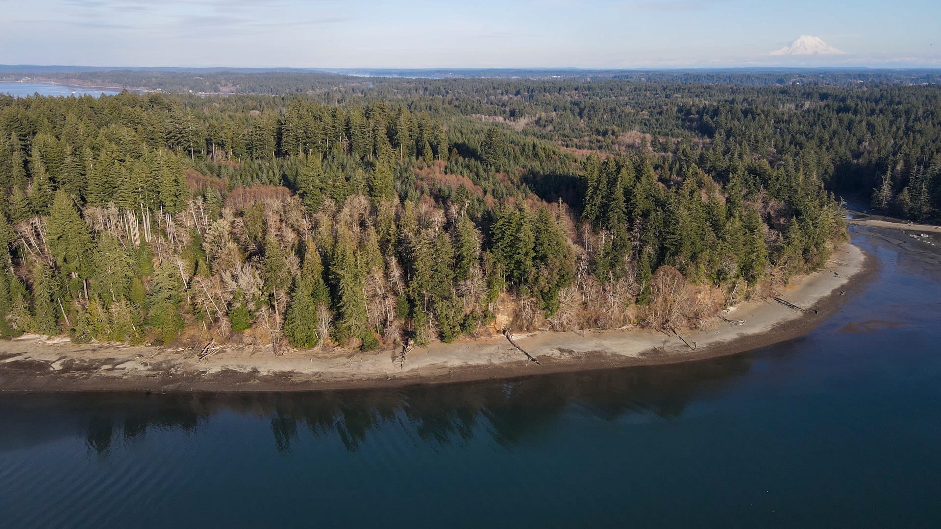
Hudson Cove’s forested shoreline is located along Puget Sound’s Totten Inlet, Mike Melton.
 

A Group Effort

“This is our most sophisticated easement so far,” says Conservation Director Alex James, adding that dollars-wise, it is also CLT’s most significant acquisition to date. Its success required coordination across multiple agencies and took several years to complete.

This conservation success was made possible by the Squaxin Island Tribe, U.S. Fish and Wildlife Service, U.S. Environmental Protection Agency, Washington Department of Ecology, Washington Salmon Recovery Funding Board, Washington Wildlife and Recreation Program, Thurston County Conservation Futures, ADESA LLC, South Sound Bird Alliance, Taylor Shellfish Farms, Thurston County Board of Commissioners, and supporters like you.

While this conservation easement is not open to public access, its protection safeguards the natural land and water systems of Totten Inlet, supporting wildlife, clean water, and the health of Puget Sound.

Help Conserve More Places Like Hudson Cove

Protecting marine shorelines, wetlands, forests, and salmon habitat is only possible through community support. Donate today to help conserve the lands and waters that keep South Puget Sound healthy and thriving, forever.

  • Facebook
  • Instragram
  • Youtube

  • PO Box 14065
  • Tumwater, WA 98511
  • Telephone: (360) 943-3012
  • Email:

  • Connecting to the Land Campaign
  • Who We Are
  • Our Mission
  • Board & Staff
  • Collaboration
  • Financials
  • Library
  • Get Involved
  • Trail Steward
  • Stewardship Work Parties
  • Salmon Docents at Bayshore Preserve
  • Ways To Give
  • Cash
  • Other Ways to Give
  • Become a Business Partner
  • Gifts of Land
  • Bequests, Estate Plans & Wills
  • Stocks, Donor Advised Funds, IRAs
  • Conserved Lands
  • Conservation Map
  • Conserving Key Habitats
  • Conservation Areas
  • Conserve Your Land
  • Visit A Preserve
  • Inspiring Kids Preserve
  • Managing Our Preserves
  • Donate
  • Contact
  • Events
  • News

Copyright © Capitol Land Trust All Rights Reserved. | Made by SlowClouds