• Connecting to the Land Campaign
  • Donate
  • Contact
  • Facebook
  • Instagram
  • YouTube
menu
  • Connecting to the Land Campaign
  • Visit A Preserve
    • Bayshore Preserve Reopens
  • Who We Are
    • Our Mission
    • Board & Staff
    • Collaboration
    • Financials
    • Library
  • Conserved Lands
    • Conservation Map
    • Conserving Key Habitats
    • Conservation Areas
      • Budd & Henderson Inlets
        • Bayfield Resource Co. Forest Conservation Easement
        • Bayfield Resource Co. Gull Harbor Conservation Easement
        • Brown Preserve
        • Cushman Conservation Easement
        • Hale Preserve
        • Harmony Farm Preserve
        • Howe Conservation Easement
        • Lonseth Preserve
        • Scheidt-Mayer Conservation Easement
        • Stephens Preserve
        • Woodland Creek
      • Black River / Chehalis Watershed
        • Aldridge Conservation Easement
        • Baretich Conservation Easement
        • Bergquist Conservation Easement
        • Black River Conservation Easement and Preserve
        • Darlin Creek Preserve
        • Davis Conservation Easement
        • Decker Creek Wetland Complex
        • DeFelice Preserve
        • Edwards Conservation Easement
        • Gordon Farm Conservation Easement
        • Heertje Conservation Easement
        • Holm-Rader Farm Conservation Easement
        • Leitner Prairie Conservation Easements
        • Tilley Wetlands Preserve
        • West Rocky Prairie
      • Cowlitz Watershed
        • Cowlitz River Preserve
      • Deschutes Watershed
        • Anderson Preserve
        • Bentley Conservation Easement
        • Bush Prairie Farm Conservation Easement
        • Parsons Family Farm Conservation Easement
        • Shermer-Deschutes Preserve
        • Springer Lake Preserve
        • Spurgeon Valley Preserve
        • Stewart Conservation Easement
        • Stewart-Deschutes Preserve
        • Yale Preserve
      • Green Cove Creek Wetlands
        • Harper Conservation Easement
        • Kaiser Preserve
        • LOTT Alliance Conservation Easement
        • Ekar-Overhulse Preserve
        • Paul-Leigh Conservation Easement
        • SPSCC Foundation Property
        • YWCA
      • Hood Canal
        • Brothers Beach Conservation Easement
      • Oakland Bay & Goldsborough Creek Watershed
        • Bayshore Preserve
        • Granquist Preserve
        • Hilburn Preserve
        • North Fork Goldsborough Creek Preserve
        • Oakland Bay Historical Park Conservation Easement
        • Olli Conservation Easement
        • Pannell Preserve
        • Rose Preserve
        • North Fork Goldsborough Creek Preserve – Rose Addition
        • Sunset Bluffs
        • Twin Rivers Ranch Preserve
      • Steamboat Conservation Partnership Region
        • Adams Cove Preserve
        • Appleby Conservation Easement
        • Davidson-Bergman Conservation Easement
        • Lower Eld Preserve
        • McIntyre Conservation Easement
        • McLane Point Preserve/Conservation Easement
        • Randall Preserve / Allison Springs
        • Schmidt Conservation Easements
        • Triple Creek Farm Conservation Easement
        • Willits Conservation Easement
        • Willits Tree Farm Conservation Easement
        • Wynne Tree Farm Conservation Easements
    • Inspiring Kids Preserve
    • Conserve Your Land
    • Managing Our Preserves
  • News
  • Events
  • Ways To Give
    • Cash
    • Stocks, Donor Advised Funds, IRAs
    • Bequests, Estate Plans & Wills
    • Gifts of Land
    • Other Ways to Give
    • Become a Business Partner
  • Donate
  • Contact
  • Connecting to the Land Campaign
  • Visit A Preserve
    • Bayshore Preserve Reopens
  • Who We Are
    • Our Mission
    • Board & Staff
    • Collaboration
    • Financials
    • Library
  • Conserved Lands
    • Conservation Map
    • Conserving Key Habitats
    • Conservation Areas
      • Budd & Henderson Inlets
        • Bayfield Resource Co. Forest Conservation Easement
        • Bayfield Resource Co. Gull Harbor Conservation Easement
        • Brown Preserve
        • Cushman Conservation Easement
        • Hale Preserve
        • Harmony Farm Preserve
        • Howe Conservation Easement
        • Lonseth Preserve
        • Scheidt-Mayer Conservation Easement
        • Stephens Preserve
        • Woodland Creek
      • Black River / Chehalis Watershed
        • Aldridge Conservation Easement
        • Baretich Conservation Easement
        • Bergquist Conservation Easement
        • Black River Conservation Easement and Preserve
        • Darlin Creek Preserve
        • Davis Conservation Easement
        • Decker Creek Wetland Complex
        • DeFelice Preserve
        • Edwards Conservation Easement
        • Gordon Farm Conservation Easement
        • Heertje Conservation Easement
        • Holm-Rader Farm Conservation Easement
        • Leitner Prairie Conservation Easements
        • Tilley Wetlands Preserve
        • West Rocky Prairie
      • Cowlitz Watershed
        • Cowlitz River Preserve
      • Deschutes Watershed
        • Anderson Preserve
        • Bentley Conservation Easement
        • Bush Prairie Farm Conservation Easement
        • Parsons Family Farm Conservation Easement
        • Shermer-Deschutes Preserve
        • Springer Lake Preserve
        • Spurgeon Valley Preserve
        • Stewart Conservation Easement
        • Stewart-Deschutes Preserve
        • Yale Preserve
      • Green Cove Creek Wetlands
        • Harper Conservation Easement
        • Kaiser Preserve
        • LOTT Alliance Conservation Easement
        • Ekar-Overhulse Preserve
        • Paul-Leigh Conservation Easement
        • SPSCC Foundation Property
        • YWCA
      • Hood Canal
        • Brothers Beach Conservation Easement
      • Oakland Bay & Goldsborough Creek Watershed
        • Bayshore Preserve
        • Granquist Preserve
        • Hilburn Preserve
        • North Fork Goldsborough Creek Preserve
        • Oakland Bay Historical Park Conservation Easement
        • Olli Conservation Easement
        • Pannell Preserve
        • Rose Preserve
        • North Fork Goldsborough Creek Preserve – Rose Addition
        • Sunset Bluffs
        • Twin Rivers Ranch Preserve
      • Steamboat Conservation Partnership Region
        • Adams Cove Preserve
        • Appleby Conservation Easement
        • Davidson-Bergman Conservation Easement
        • Lower Eld Preserve
        • McIntyre Conservation Easement
        • McLane Point Preserve/Conservation Easement
        • Randall Preserve / Allison Springs
        • Schmidt Conservation Easements
        • Triple Creek Farm Conservation Easement
        • Willits Conservation Easement
        • Willits Tree Farm Conservation Easement
        • Wynne Tree Farm Conservation Easements
    • Inspiring Kids Preserve
    • Conserve Your Land
    • Managing Our Preserves
  • News
  • Events
  • Ways To Give
    • Cash
    • Stocks, Donor Advised Funds, IRAs
    • Bequests, Estate Plans & Wills
    • Gifts of Land
    • Other Ways to Give
    • Become a Business Partner

News
June 23, 2026

The Value of a New Perspective: Spotting Scotch Broom by Drone at Little Skookum Inlet Preserve

CameraDrone monitoring of invasive plant species like Scotch broom elevates stewardship efforts at Little Skookum Inlet Preserve.

  • ShareShare this post on Facebook
  • Share this post on FacebookTweet
Land Trust Accreditation Commission
Donate Today

Learn More About Us

  • Conserved Lands
  • Conservation Map
  • Conserving Key Habitats
  • Conservation Areas
  • Conserve Your Land
  • Visit A Preserve
  • Inspiring Kids Preserve
  • Managing Our Preserves

How Capitol Land Trust’s stewardship team is using aerial imagery to enhance monitoring of our protected lands and waters

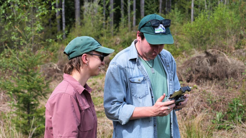
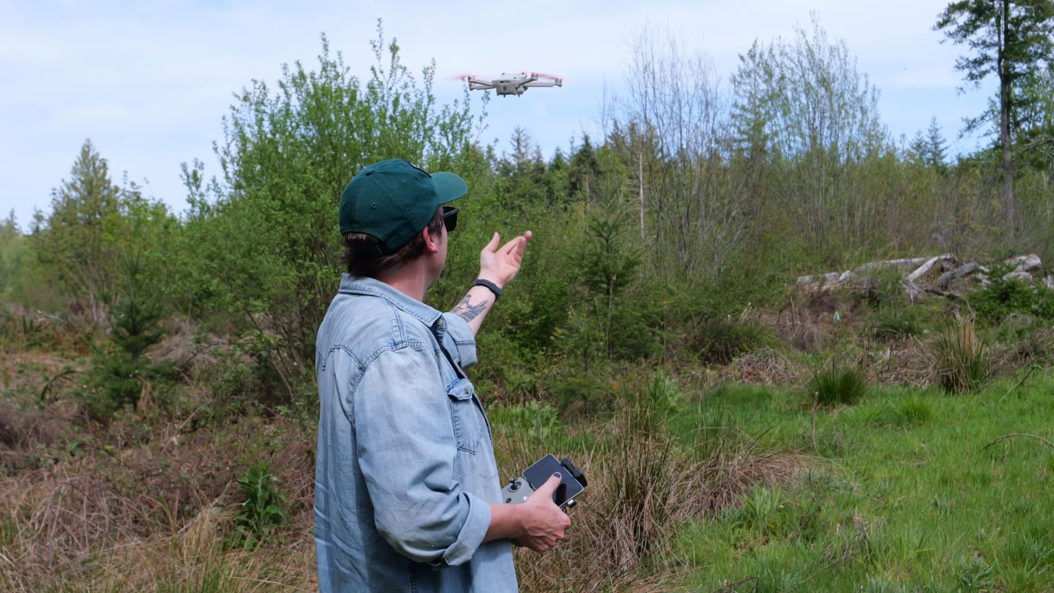
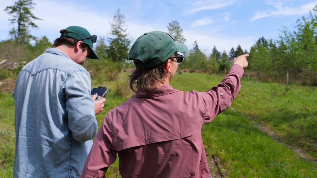
High above the forested shoreline of Puget Sound’s Little Skookum Inlet, a small drone hums as it surveys the landscape, its camera searching for patches of yellow blooming in the clearing below. Down on the ground, Stewardship Manager Matt Faller monitors the live feed on a handheld screen, making minor adjustments to the drone’s flight path as he scans for the few remnants of Scotch broom that persist across this 66-acre preserve.

Public Access Manager Logan Butler (left) and Stewardship Manager Matt Faller (right) keep an eye on the drone’s flight path using the live feed broadcast to a monitoring screen.

A Small Place Supporting Big Biodiversity

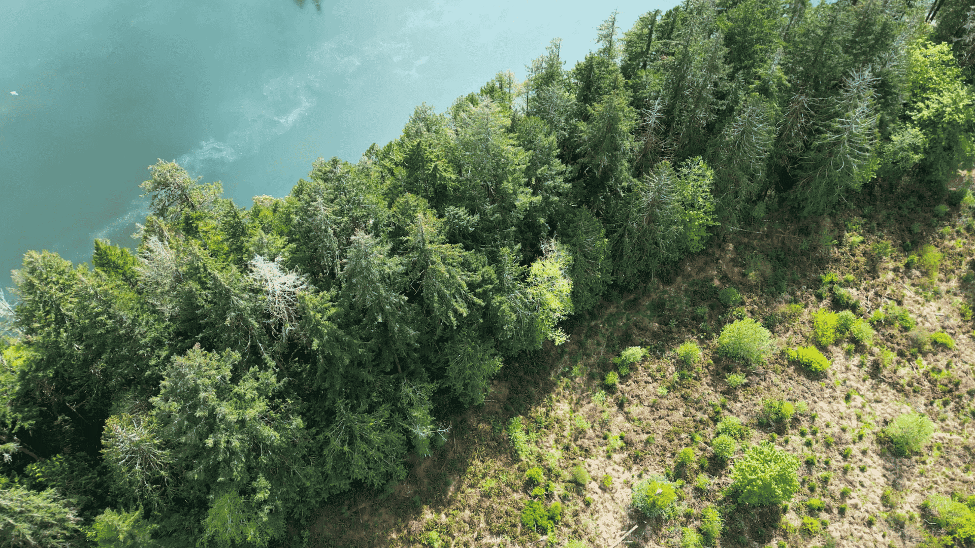
Conserved by Capitol Land Trust in 2025, Little Skookum Inlet Preserve protects forest, wetlands, and shoreline along a narrow tidal waterway that connects the Skookum Creek estuary to Totten Inlet and the broader Puget Sound. This year marks the first season of annual monitoring since the property’s baseline survey last year.

Despite its comparatively small size, the site boasts a wide range of habitats including 3,200 feet of marine shoreline, 1,900 feet of fish-bearing stream, and 6.3 acres of freshwater and marine wetlands. This diverse aquatic ecosystem supports many fish including several species of salmon, whose offspring rely on the safety of the preserve’s pocket estuary.

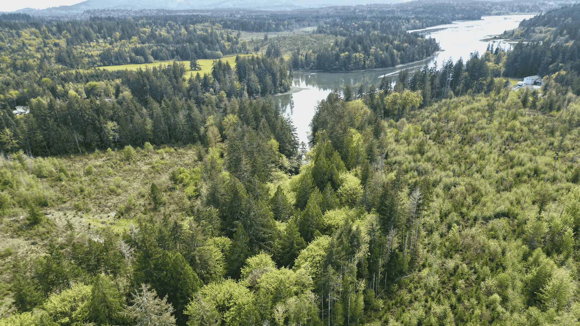
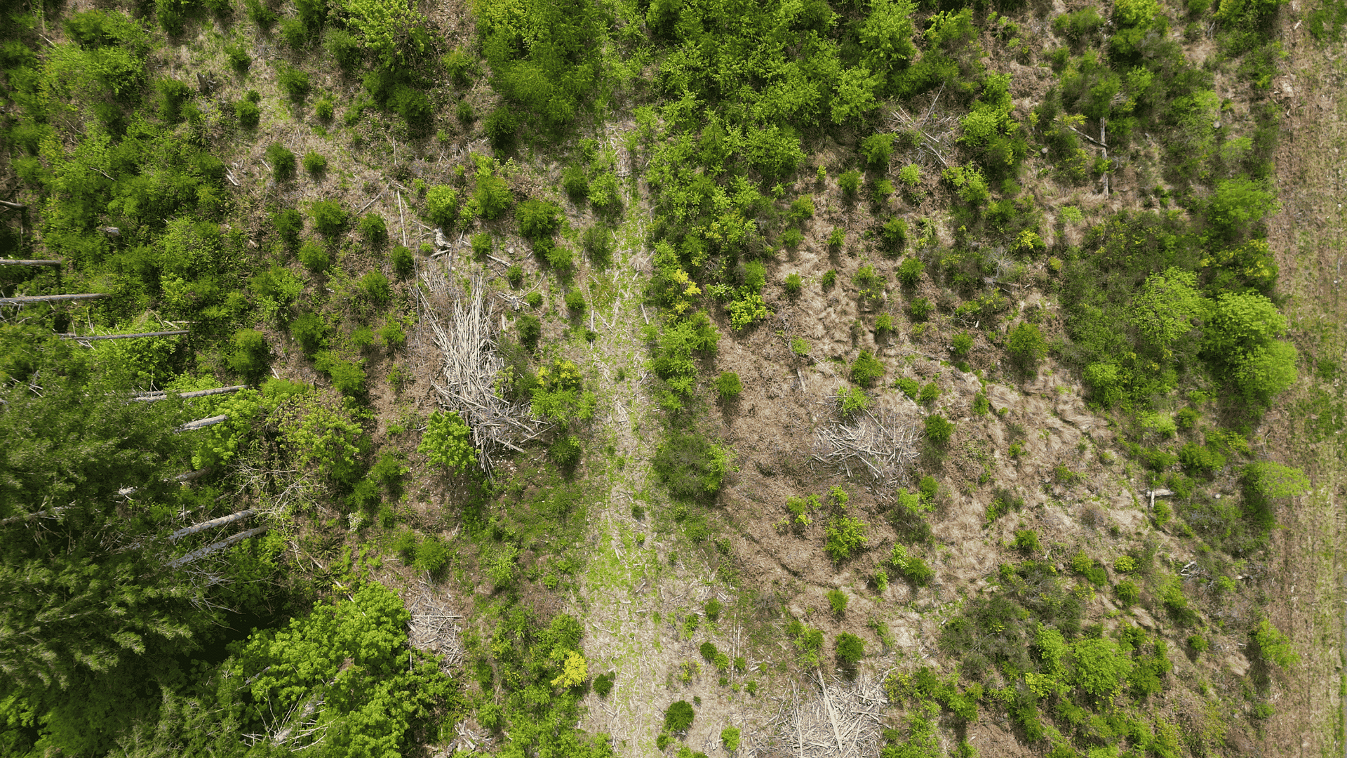
An unnamed stream flows through the center of this 66-acre preserve into Little Skookum Inlet and the greater Puget Sound.

The property’s forests range from young stands harvested as recently as 2019 — where the Scotch broom attempts to encroach — to 80-year-old shoreline and streamside forests that shelter pollinators, birds, and land mammals such as deer, coyotes, and fox. Douglas fir, western redcedar, western hemlock, red alder, bigleaf maple, and madrone make up the forest’s canopy, while an understory of ferns, salal, huckleberry, Oregon grape, vine maple, and trailing blackberry grow underneath.

The Goal is Not Complete Control, It is Fostering Resilience

In the short-term, complete eradication of the invasive plants that compete with native species isn’t the goal of CLT’s stewardship efforts, nor is it realistic. Part of what makes Scotch broom so highly invasive is that its seeds can lie dormant in the soil for years before sprouting, and a single plant may produce thousands of seeds each year.

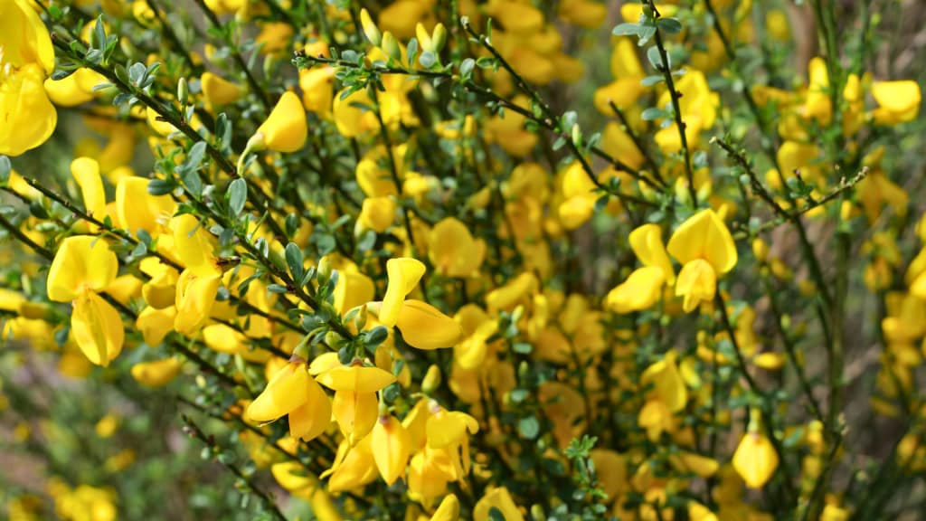
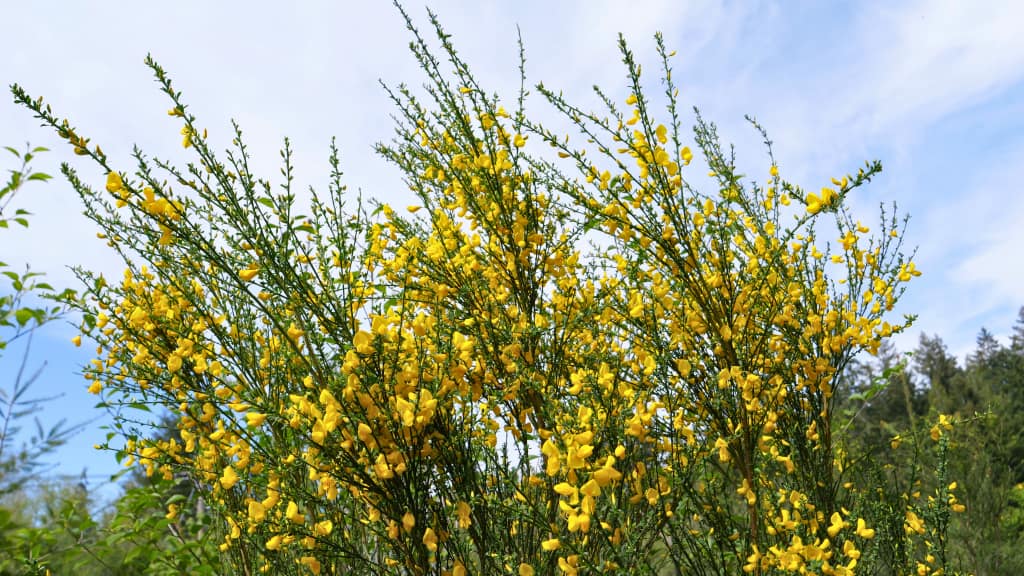
Scotch broom is not just invasive due to its numerous seeds.
As a member of the legume family, it is also able to grow in areas with reduced soil quality.

Instead, the goal is to give nature an opportunity to restore itself by implementing strategies that reflect a deeper understanding of how species interact within the landscape over time. With the help of volunteers, our stewardship team has been thinning Scotch broom and replanting Douglas fir trees in key areas. As these trees continue to grow, the sun-loving Scotch broom will eventually lose its advantage.

“It’s unfeasible to quickly eradicate Scotch broom from here completely,” explains Public Access Manager Logan Butler. “But if we can reduce competition by pulling it where we can, native plants will have more time to eventually shade it out.”

This long-term approach to stewardship recognizes the inherent resilience of nature to thrive when provided the right conditions. Given enough time and a head start through strategic restoration, the diverse native plant species already growing at the preserve will have a chance to fully reestablish themselves and crowd out the Scotch broom for good.

Eyes in the Sky: How Technology Enhances Efforts on the Ground

Until that time comes, the stewardship team will continue monitoring for remaining Scotch broom, using that information to more precisely target future restoration efforts. This is where drone technology comes in.

Matt Faller earned his remote pilot certification two years ago and has been flying for Capitol Land Trust ever since.

Drones allow our team to cover more ground with the time they have and detect problems before they spread. This year’s aerial imagery will be compared with past surveys to create a more complete understanding of how the site is changing across time and seasons. And all of it is being achieved without having to walk more than a few footsteps.

“Inherently, when we monitor a site, it can have an impact,” Faller says. For instance, new growth might be trampled underfoot or invasive seeds might be unintentionally carried to new areas.

“The drone is not a tool to replace everything,” he explains, “but rather to enhance other on-the-ground monitoring techniques.”


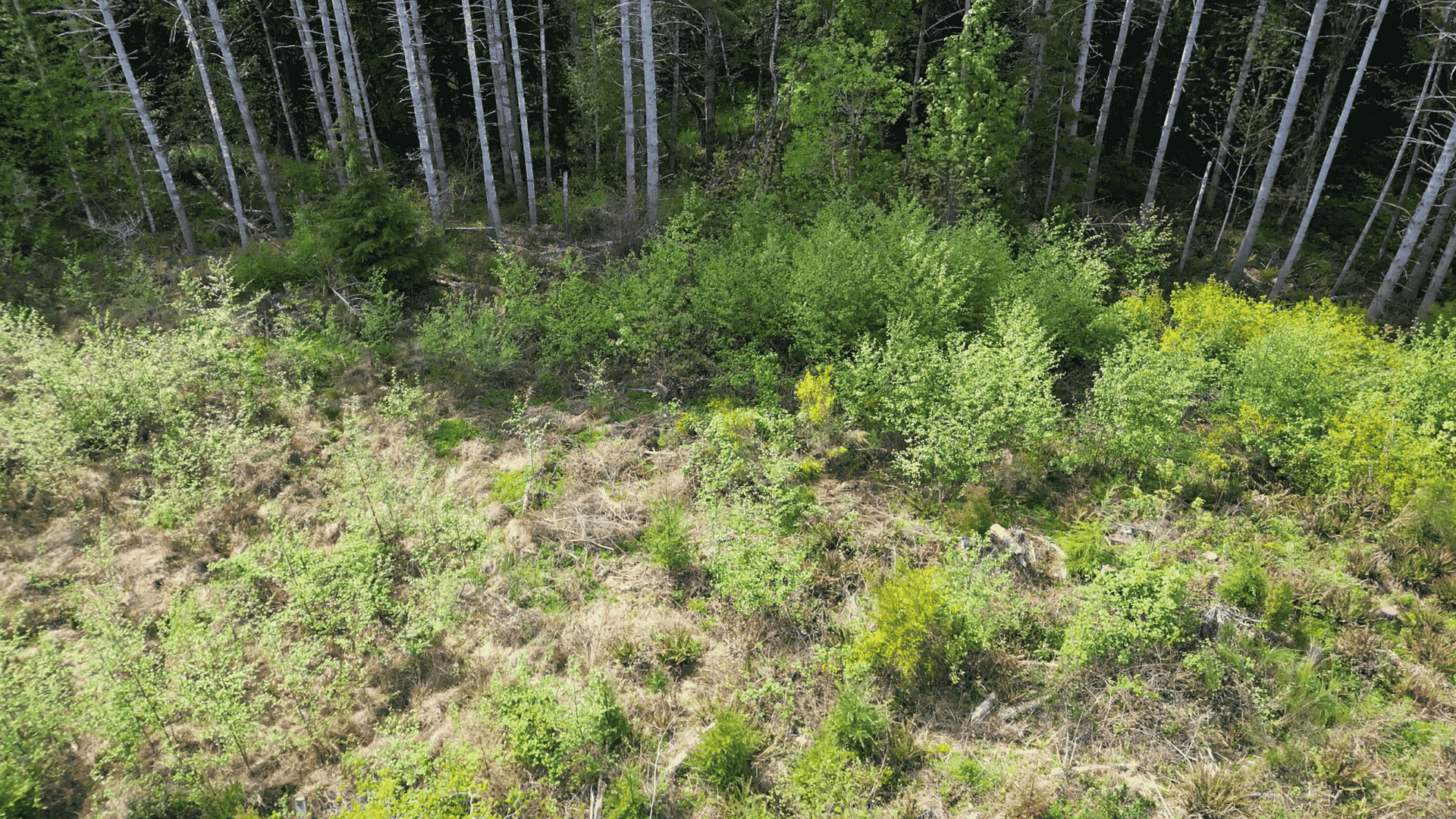
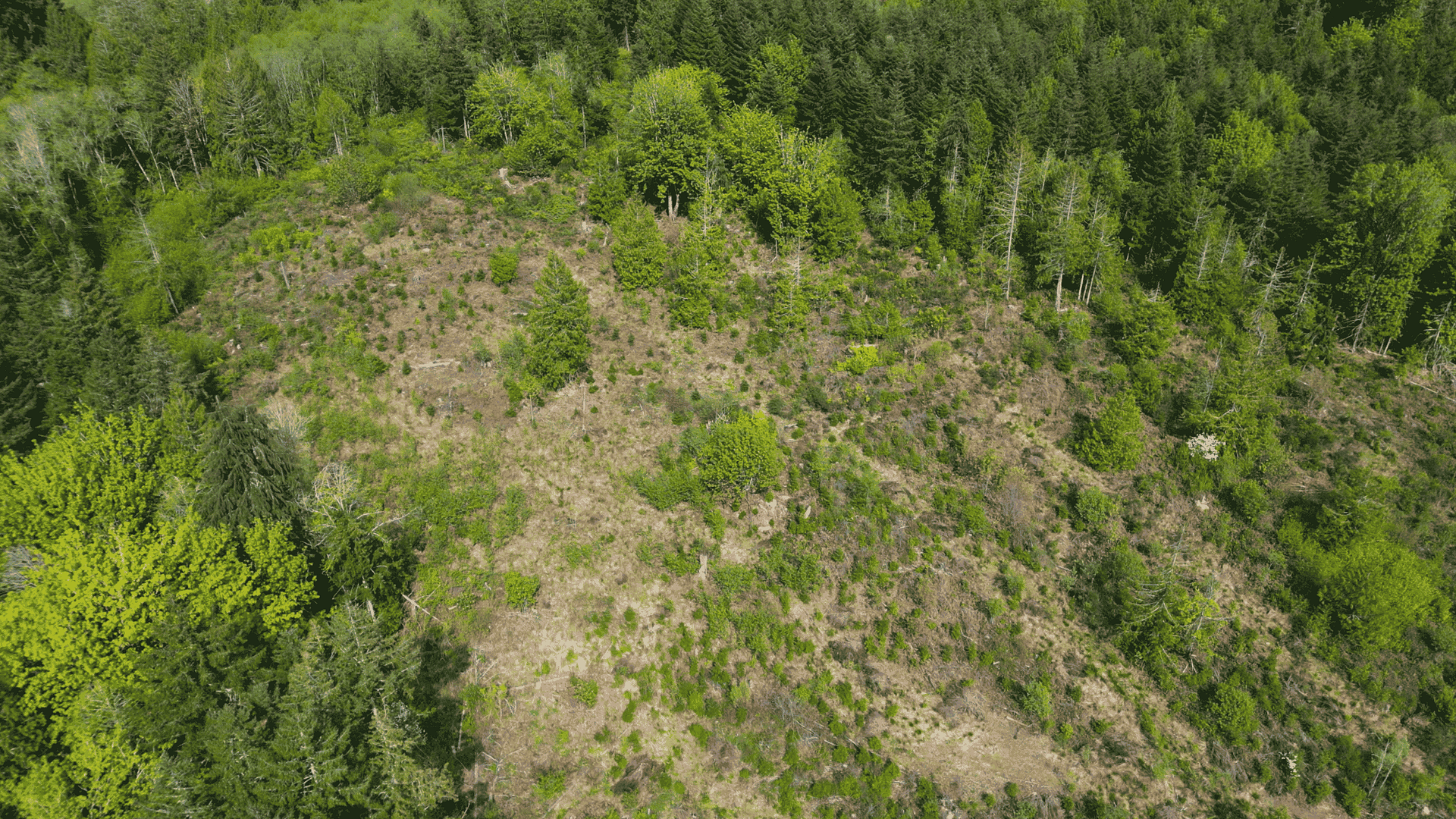
From the air, the team can spot patches of Scotch broom between the foliage and map where it’s spreading or retreating without having to set foot in sensitive areas.

“Besides,” Faller adds, “there is nothing more valuable than a new perspective.”

Your Help Makes Protection of Places Like This Possible

The ongoing conservation and stewardship of the diverse habitats at places like Little Skookum Inlet Preserve is only possible through community support. Consider donating today to help conserve the lands and waters that keep South Puget Sound healthy and thriving.

  • Facebook
  • Instragram
  • Youtube

  • PO Box 14065
  • Tumwater, WA 98511
  • Telephone: (360) 943-3012
  • Email:

  • Connecting to the Land Campaign
  • Who We Are
  • Our Mission
  • Board & Staff
  • Collaboration
  • Financials
  • Library
  • Get Involved
  • Trail Steward
  • Stewardship Work Parties
  • Salmon Docent
  • Ways To Give
  • Cash
  • Other Ways to Give
  • Become a Business Partner
  • Gifts of Land
  • Bequests, Estate Plans & Wills
  • Stocks, Donor Advised Funds, IRAs
  • Conserved Lands
  • Conservation Map
  • Conserving Key Habitats
  • Conservation Areas
  • Conserve Your Land
  • Visit A Preserve
  • Inspiring Kids Preserve
  • Managing Our Preserves
  • Donate
  • Contact
  • Events
  • News

Copyright © Capitol Land Trust All Rights Reserved. | Made by SlowClouds